|
|
|
Integrated mapping software featuring image processing, map production, 3D presentations and GIS integration, for Windows 95/NT and Unix
|
|
Integrated mapping software featuring image processing, map production, 3D presentations and GIS integration, for Windows 95/NT and Unix |
|||
|
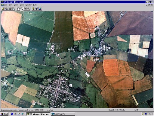
Image courtesy of the National Remote Sensing Centre, UK |
ER Viewer is an easy to
use image viewer featuring interactive roaming and
zooming of very large image files. ER Viewer is also OLE
enabled for image viewing inside your favourite Windows
applications.
|
| * All product and company names are trademarks or registered trademarks of their respective owners. | ER Mapper is a member of CHEST educational agreement. |
To Contact ER Mapper: Earth Resource Mapping, Blenheim House, Crabtree Office Village, Eversley Way, Egham, Surrey, TW20 8RY : Tel: +44 1784 430 691 : Fax: +44 1784 430692 : Email: queries@ermapper.co.uk